Sign In
Upcoming Event
 Free Newsletter

NWS and AccuWeather forecast warm, dry fall with wildfire risk in the northwest
reuters//August 27, 2026//
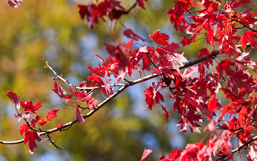
Bright red leaves stay on a tree in Victor Ashe Park as the leaves start to change colors for the fall in Knoxville, Tenn., on Oct. 31, 2025. (FILE PHOTO: VIA REUTERS)
NWS and AccuWeather forecast warm, dry fall with wildfire risk in the northwest
reuters//August 27, 2026//


Fall is a month away, but forecasters at AccuWeather and the National Weather Service say people should expect a warm, dry season with an increased risk to see plumes of wildfire smoke, especially in the Mountain West.
AccuWeather released its 2026 fall weather forecast for the U.S. recently, and the climate pattern El Niño is expected to largely determine the fall and winter conditions across the U.S. The southern U.S. is forecast a wetter-than-usual season, which could prompt flooding, while the northern U.S. is forecast drier air, which could worsen drought or cause wildfires.
“The greatest wildfire threat this fall will be across the interior Northwest, including eastern Oregon, eastern Washington, Idaho, Montana and parts of northern Utah,” AccuWeather Lead Long-Range Expert Paul Pastelok said in the Aug. 10, 2026, fall forecast. “These areas are expected to miss out on much of the monsoonal moisture from the south, allowing dry conditions to persist. Dry thunderstorms are often the spark that ignites new fires, and once they start, wind can quickly drive rapid fire growth.”
El Niño, a natural warming of seawater in the Pacific Ocean, affects weather and climate patterns around the world. Impacts often include a boost of hurricanes in the Pacific basin and a spike in global temperatures, as well as droughts and flooding in many areas.
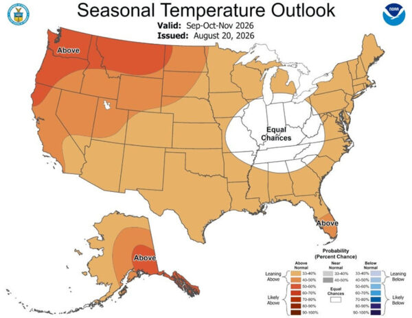
The National Weather Service’s seasonal outlooks for weather from September to November shows Michigan experiencing mostly above-average temperatures and below-average rain.
The increased risk for wildfires may impact Michigan as smoke could billow into the Midwest.
“Large wildfires could send smoke across the Rockies, Great Lakes and into parts of the Northeast and mid-Atlantic, reducing air for millions,” according to AccuWeather. “Canadian wildfire smoke may also periodically impact the Great Lakes and Northeast.”
The southern U.S. will experience the opposite conditions as tropical moisture, and El Niño are to usher in heavy rain which could cause flash floods.
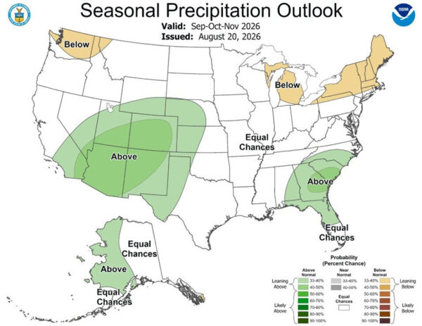
“An active monsoon pattern combined with surges of tropical moisture from the eastern Pacific is expected to bring repeated rounds of heavy rain to the Southwest through the early part of the fall. While the rainfall may provide some drought relief, it will also increase the risk of flash flooding. El Niño could help direct additional Pacific storm systems into Southern California later in the season, raising the potential for heavier rainfall and an atmospheric river,” according to AccuWeather.
Snowfall predictions vary by region, based on the El Niño’s progression into winter. Forecasters noted the northeastern U.S. could see significant “snowfall event” in November.
“AccuWeather expert meteorologists believe there is a 90% chance a Super El Niño forms, which will become a dominant climate driver throughout the fall, influencing temperatures, precipitation patterns, storm tracks and tropical activity across the country,” AccuWeather said.
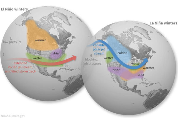
The AccuWeather forecast does not detail a temperature for the Midwest, but under an El Niño the fall and winter temperatures are typically warmer than usual.
Forecasters did say the northwest and northeast regions will see warm air, hence the increased risk for drought and wildfires.
What is El Niño?
El Niño is a natural climate pattern in which surface seawater temperatures in the central and eastern tropical Pacific Ocean are warmer than average.
Its name means the Little Boy, or Christ Child in Spanish. El Niño was originally recognized by fishermen off the coast of South America in the 1600s with the appearance of unusually warm water in the Pacific Ocean around Christmas.
The entire natural climate cycle is officially known as El Niño – Southern Oscillation, called ENSO by scientists. The cycle swings between warmer and cooler seawater in a region along the equator in the tropical Pacific. La Niña is marked by cooler-than-average ocean water in the region.
How long will El Niño last?
Although predicted to be a potent one, the predicted seven-month-long duration of this El Niño event is not unusually long, according to Michelle L’Heureux, physical scientist and ENSO team lead at NOAA’s Climate Prediction Center. “I don’t see anything atypical about the starting season or potential duration of this El Niño,” she said in an email to USA TODAY.
USA TODAY contributed to this report.
This article originally appeared on Lansing State Journal: “NWS, Accuweather say expect a warm, dry fall in 2026. Here’s why”
Reporting by Sarah Moore, USA TODAY Network, Lansing State Journal via Reuters Connect.





 Loading ...